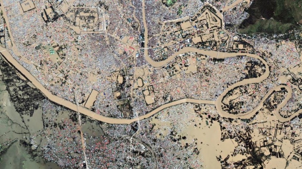
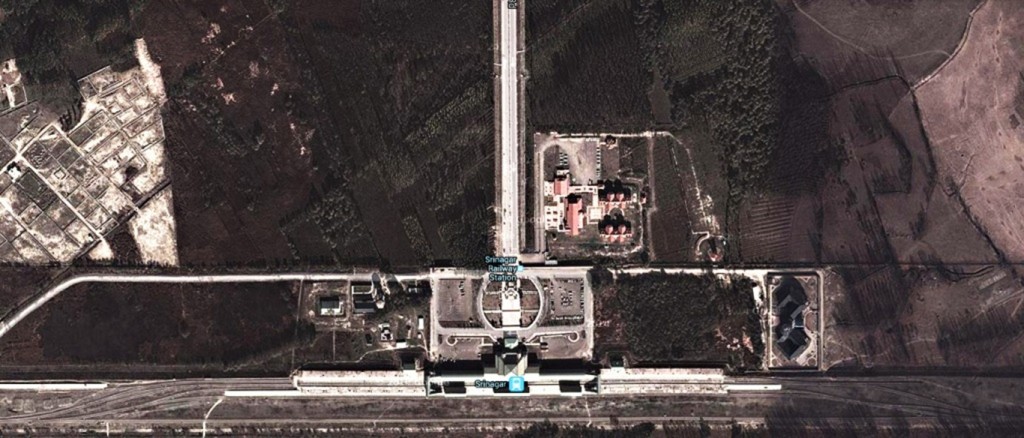
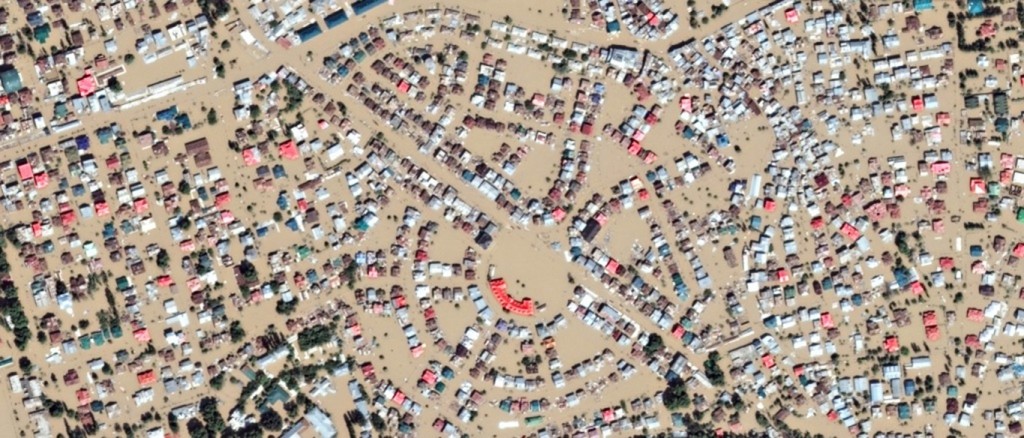
A satellite image of Srinagar, as viewed on Google Crisis Maps. September 2014. The flood channel dug in 1904 exits from a bend in the Jhelum and goes to the left of the picture.
The Vale of Kashmir is an intermontane valley, flanked by the main range of the Himalayas on the northeast and the Pir Panjal Range on the southwest. It is an ancient lake basin about 85 miles (140 km) long, 20 miles (32 km) wide, and 5,300 feet (1,620 metres) high that is drained by the upper Jhelum River. The population of the Kashmir region is concentrated in the valley, at the centre of which lies Srinagar, the summer capital. The fertile alluvial soil yields rice, corn, saffron, fruit, and vegetables, and the scenic mountains and lakes (notably Wular, Dal, and Nagin) attract many tourists.
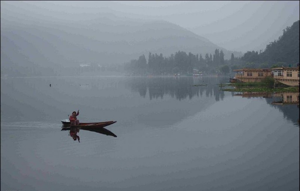
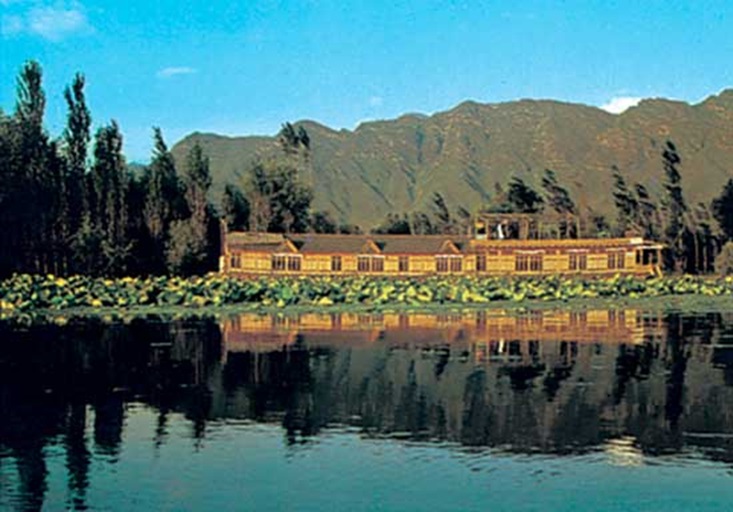
The Dal Lake at Srinagar
The river Jhelum originates at Verinag at the southeastern edge of the Valley. It flows northwest through Srinagar into the shallow Wular lake. The Wular lake’s size varies seasonally from 12 to 100 square miles (30 to 260 square kilometers). The Jhelum exits Wular lake at Sopore, flows through Baramulla and starts its descent a few kilometres later at Khadanyar.
The Wular Lake
Those not familiar with the Valley should note that Srinagar sits in an alluvial plain more akin to Kolkata than a hill town. There is a drop in river level of only 35 metres from Srinagar to Baramulla – a distance of 55 km by road and much greater by river. In fact, the river meanders between Srinagar and Baramulla. It is well known as a flood prone area. In recent history, there was a major flood in 1902 when portions of Srinagar city remained submerged for two years. The Maharaja sought help from the then British government, who dispatched a team of engineers. The British team dredged the Jhelum from the mouth of Wular upto Khadanyar, a few km downstream of Baramula. A 42 km long flood channel was also constructed from Padshahi Bagh (Srinagar) to Wular. This flood channel is designed to carry 1/3 the expected flood flow of 1,50,000 cusecs.
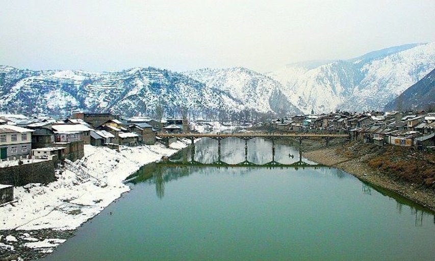
Baramulla in winter
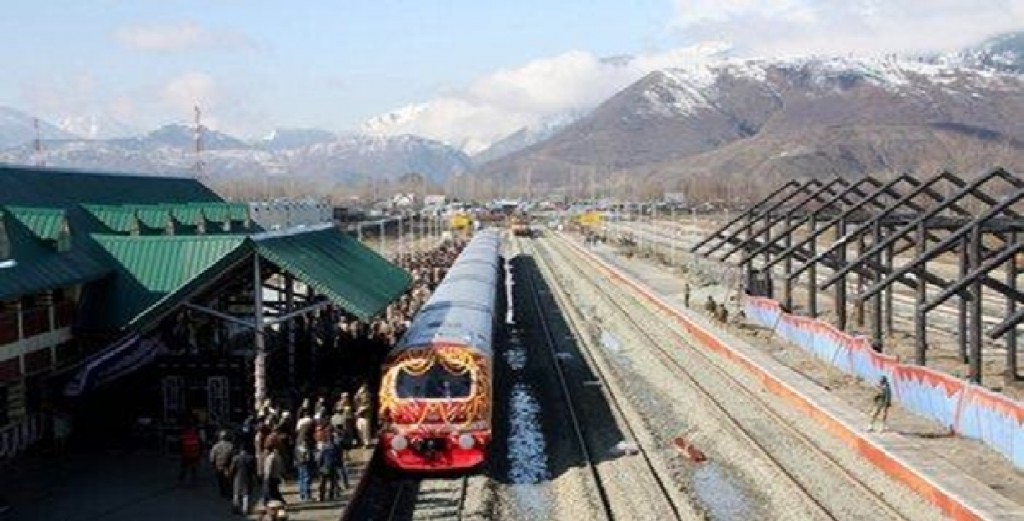
Baramulla Rail Station
In 1948 Sheikh Abdullah requested Prime Minister Nehru for a dredger. Nehru acceded to the request and commissioned the dredger himself. It was used for regularly desilting the flood channels and the river itself. When a major flood occurred in 1959, some areas of the city were submerged, but there was no loss of life or property.
In 1976 government constituted the Uppal committee who recommended various measures for flood control. However, no action seems to have been taken. Instead silt has accumulated in all the major tributaries and the flood channel. In fact, the then minister for flood control and irrigation, Taj Mohi-ud-Din, is on record that even the Srinagar Development Authority has constructed a shopping complex on the flood channel.
[See http://www.greaterkashmir.com/news/2010/Feb/12/srinagar-awaits-catastrophe-57.asp dt 11 Feb 2010 ]
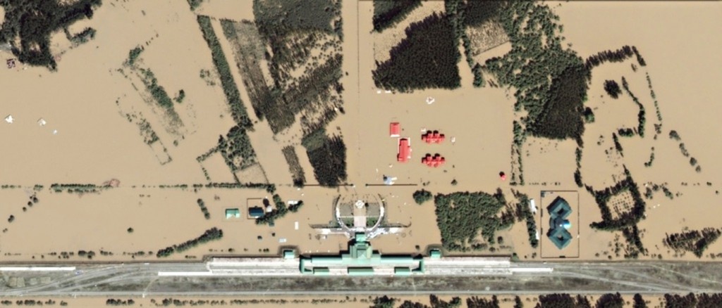
Before
Railway Station
On the outskirts of Srinagar, the floods have inundated almost everything at the Nowgam Railway Station, except the railway tracks and the main terminal
After
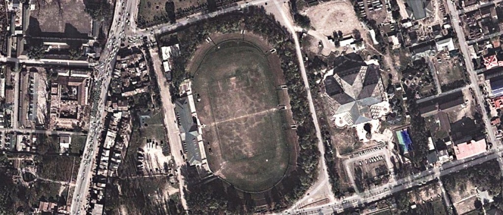
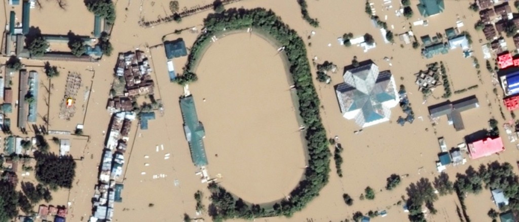
Bakshi Stadum Before
Bakshi Stadium
The state’s first synthetic football pitch was laid at the Bakshi stadium just days before it almost completely went under water.
Bakshi Stadum After
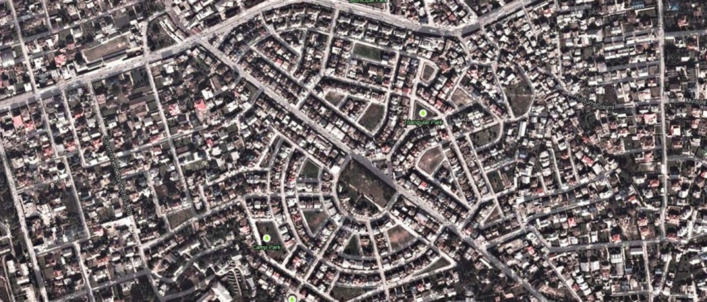
Before
Triangular Park, Jawahar Nagar
Roads and parks in Srinagar were completely submerged, leaving only rooftops and a smattering of treetops visible from above.
After
After the excellent work done by the British team in 1902 – 04 and the state government team in the 1950s, the people and the government became complacent and negligent. Reliance was placed entirely on the embankments (bunds) that have been built on either side of the Jhelum. Bunds can supplement dredging but are never a complete solution by themselves. Over time, the river silts up and the level rises. To counter this, the bunds have to be raised further. This process continues till we get the weird spectacle of the river bed being higher than the city.
Bunds have another problem. What do we do about the tributary streams that join the river ? When the main river level rises, water will flow backwards in these tributaries. That would flood the city. So the bunds have to block the tributaries. And then, flood channels have to be dug to divert the tributaries till they join the main river many kilometres downstream.
It all adds up to a complicated, expensive and inefficient system. And dangerous to boot. Whenever the bund is breached, or if the river level rises above the bund, severe floods result. The entire river empties into the city. And that is exactly what happened on 07 September 2014.
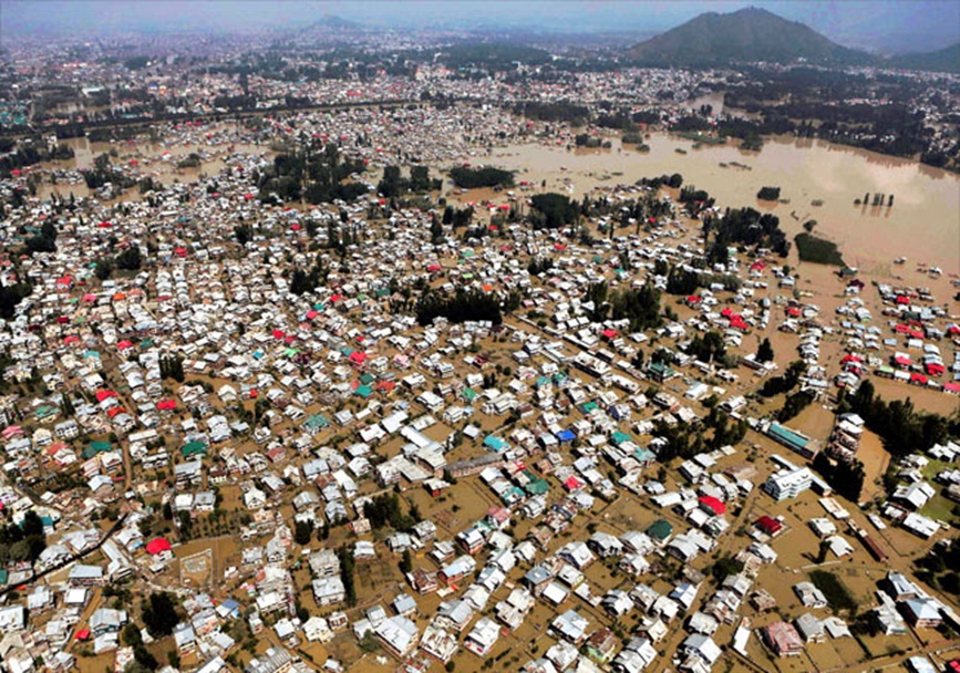 An aerial view showing buildings partially submerged in Srinagar. Photo: PTI.
The entire Jhelum valley, including portions in Pakistan, got flooded
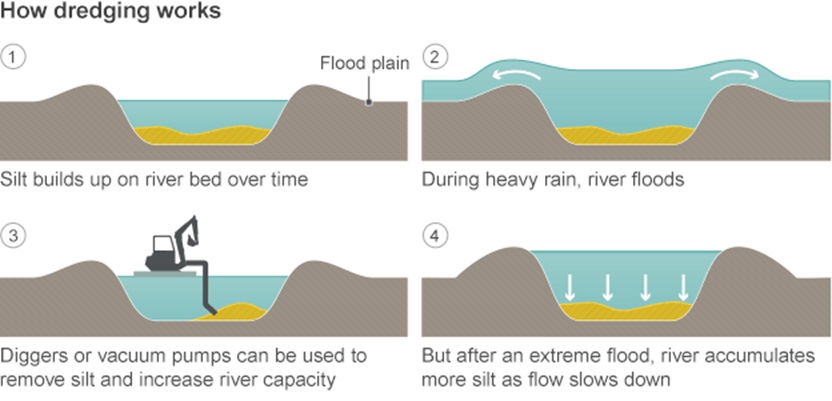
Far simpler, better and less expensive to dredge and de-silt the river. Then, if at all the river floods, only a small fraction of the water will overflow the banks. As in 1959, the impact will be minor and limited to the flood plain.
After the initial capital dredging, maintenance dredging has to continue
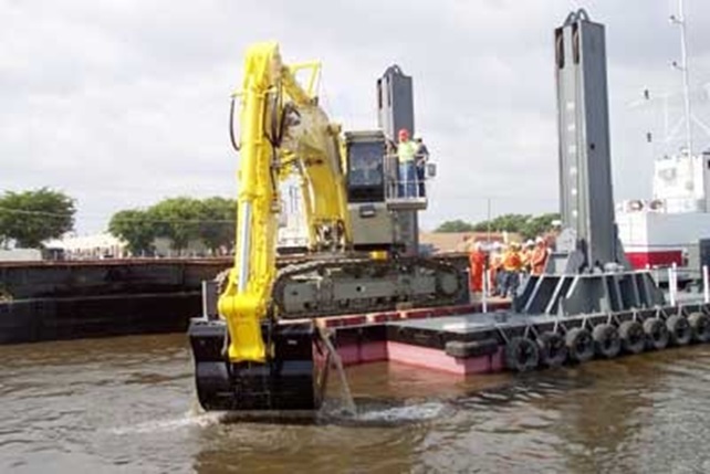
A dredger in operation
The basics of fluid flow, as applicable to a river, are given in the Annex. The important point is that the cross sectional area available to the river must be large enough to cater to the volumetric flow during floods. The volumetric flow is equal to A x V, where A is the cross sectional area and V is the velocity of the water. The velocity is determined by the slope of the land and is beyond our control. Dredging and de-silting — and, therefore, cross sectional area — is within our control.
All rivers have a normal wet season level. This determines the width of the river channel. However, every now and then, the river will flood. The area which floods occasionally is called the flood plain.
In ancient times, when the pressure on land was low, people avoided building houses in the flood plain. It was used for agriculture. But, as the population increased, urbanisation set in and the flood plains became filled with buildings. People also built bunds to “keep out floods.” The problem is that, if and when the bunds are breached, the floods become more severe.
Almost the entire city of Srinagar sits in the flood plain of the Jhelum river. Any breach of the bunds in Srinagar inevitably causes the whole city to become a lake.
WHAT NEXT ?
After the initial rescue phase, thought will have to be given to how best to repair the damage and rebuild the city.
Breaches to the bunds need to be repaired. But, instead of raising the bunds further, it is better to dredge and de-silt the river and the flood channel.
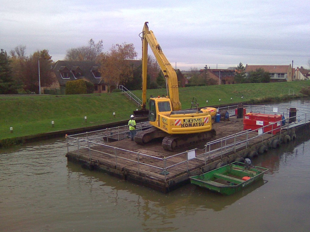
A dredger operating from a barge
While the principle is simple — increase the cross sectional area available to the river — we do have a major problem in the Valley. The river drops only about 35 metres while flowing a distance of about 75 km from Srinagar to Khadanyar, near Baramulla. So local dredging at Srinagar is not enough. We need a massive dredging programme all the way unto Khadanyar.
The flood channel built in 1904 is equally important. It requires deepening and widening.
In view of the urgency and the mammoth task involved, multiple dredgers and multiple contractors should be involved. Floodlights should be arranged and dredging should be done round the clock — 24 / 7 / 365.
The alternative — Plan B — is to leave Srinagar as a lake and build a new city on higher ground.
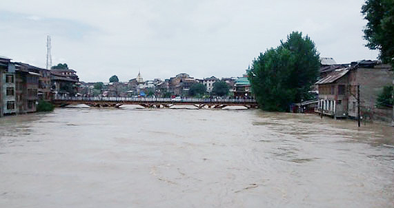
A picture of the flood affected area.
*
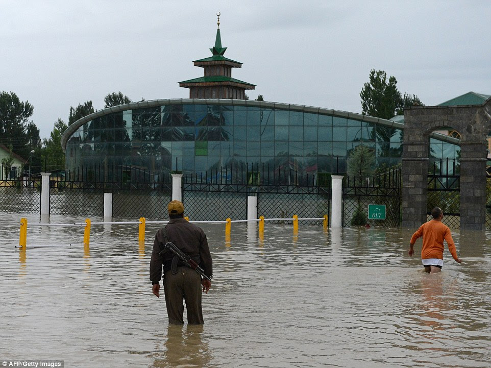
A policeman stands guard outside the Hajj House in Srinagar in the middle of the worst ever floods to hit the region. Since the city is lower than the river, the water will not drain back to the river even when the flood recedes.
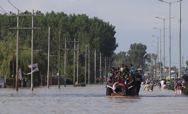
Kashmiri residents are evacuated from a flooded neighborhood on a tractor in Srinagar (Photo: AP)
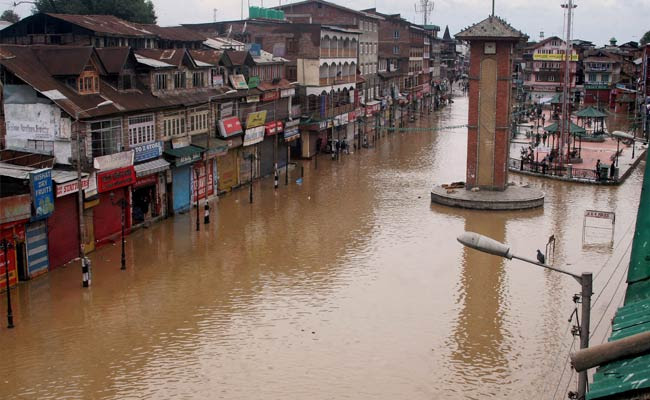
Ghanta Ghar, in the heart of Srinagar, surrounded by flood water on Sunday (Press Trust of India photo)
Annex to
Flood Prevention in the Valley
BASICS OF WATER FLOW
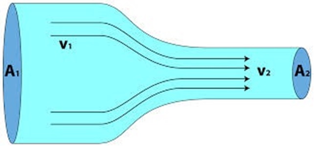
The basic law of fluid flow is the Law of Continuity which is nothing more than a corollary of the Law of Conservation of Mass.
In any pipe or fluid stream, provided there is no nuclear reaction, the mass of fluid that exits the pipe or fluid stream is equal to the mass that entered it. If the cross sectional area is A and the velocity is V, the volumetric flow is A x V. Multiply by the density, Rho, and we get the mass flow (MF). So the Law of Continuity says that MF (in) = MF (out).
For flooding of a river, think of flow from right to left in the above diagram
For the case of water flow in a river, the density changes are negligible. So we have the fundamental equation A x V = Constant.
Now, the velocity of water in a river really depends on the slope of the river bed. In the hills, the slope is steep and it causes fast flow and a narrow cross section. As the river enters the plains, the slope is less and the velocity reduces. By the Law of Continuity, the cross section of the river has to increase to compensate for the slower velocity.
The total quantity of fluid that goes past a point in unit time is called the “flow.” The volumetric flow is A x V and the mass flow is Rho x A x V. As discussed earlier, the density of water at different points in a river can be considered to be constant. Hence, water flow is customarily stated in volumetric terms. The most popular unit is “cusecs” or cubic feet per second.
Flow in a river is estimated by measuring the velocity at different points in a given cross section. By mapping the velocities in a cross sectional diagram, an estimate is made of the flow. Historical data maintained over several decades then gives the average and flood flows. A margin of safety is then added and flood control measures designed accordingly.



Er. Mohammad Ashraf Fazili FIE, (Former Chief Engineer, Govt of J&K) has presented a paper at The Institution of Engineers (India), J&K State Center,
Seminar on Jhelum Dredging Project and Floods of Sept-14 in Kashmir on 7th May, 2016, “Jhelum floods and Dredging in Kashmir.”
Please see
https://shahishaharyar.wordpress.com/2016/05/10/jhelum-floods-and-dredging-in-kashmir/#like-2516
We are delighted that the distinguished Chief Engineer has mentioned this article.
[...] http://amolak.in/web/flood-prevention-in-the-vale-of-kashmir-by-joseph-thomas/ [...]
Our article “FLOOD PREVENTION IN THE VALE OF KASHMIR” was published on 20 Sep 14, just 13 days after the catastrophic flood hit Srinagar. The response from readers was very positive but the state and central governments were fixated on constructing a second flood channel. In effect, this meant diverting the Jhelum around Srinagar. The proposal meant acquiring a large acreage of land and a lot of excavation, followed by building many bridges over the new flood channel. Worse, it would still keep the Jhelum above street level, thus posing an ever present threat to the city of Srinagar. It will be far better to dredge and de-silt the Jhelum river to bring the river bed to its original level ie below street level. This alone will take care of the flood flow of the Jhelum.
Fortunately, our proposal got support from many knowledgeable engineers, including Er Ashraf Fazili, Retd Chief Engineer, PWD, J&K. He has written articles in “Greater Kashmir” and other newspapers. It has taken some time but the Central Water Commission (CWC) also appears to have veered around to our view.
In a democracy, public opinion is very important and that is why Political Science trumps all other Science disciplines. It is, therefore, a major milestone to find Retd IGP Abdul Rashid Khan writing in “Greater Kashmir” on 10 Apr 15 :
“The September floods have left an indelible impact on our minds and in March we just escaped the fury somehow. ………..The September floods have already rendered the city into shambles and the recent rains are posing more threat to very existence of the city. The traders of the Lal Chowk during their recent interaction with the CM, were right in making the submission that the future need is to have the permanent remedial measures. Therefore the few suggestions can be thought over.
(a) Immediate dredging and de-silting of river Jhelum, Doodh Ganga, Flood spill channels of Rambagh, Rawlpora and strengthening of their embankments.
(b) ……………………..
[Full article at http://www.greaterkashmir.com/news/2015/Apr/10/save-srinagar-3.asp “
Retd IGP Abdul Rashid Khan has put forth eight recommendations, the first of which is to de-silt the Jhelum river, its tributaries and the existing flood channel. He does not even mention the grandiose idea of constructing a second flood channel.
This is a welcome development and I am cautiously optimistic that the flood problem in the Kashmir Valley will be solved.
Further light at the end of the tunnel : After talking only of a grandiose project to make a new flood channel — in effect diverting the Jhelum away from Srinagar — the authorities seem to have realised that the best way is to de-silt the Jhelum by dredging it. Dredging the existing river does not require acquisition of any land nor construction of new bridges over a new flood channel.
See http://www.greaterkashmir.com/news/2015/Apr/6/after-the-flood-scare-5.asp?&msg=Incorrect%20Security%20Code
The latest report in Greater Kashmir newspaper is that the Central Govt will take a decision on flood control measures on 07 Apr 15. Rs 401 cr are expected to be sanctioned for “dredging of river Jhelum and land acquisition to widen the river’s flood channel.”
There is no need to widen the flood channel. We need a certain cross sectional area to accommodate the expected water flow. This can be achieved by deepening the flood channel. There is no need for additional land. The money can be better spent for deepening the flood channel.
Though I should make one caveat. The current flood channel does not extend all the way to Wular Lake. It ends in a rural area. What it basically does is to divert the flood from the city to the rural areas. In case the land acquisition is for extending the flood channel upto Wular Lake, then it is a good idea and long overdue.
I’m cautiously optimistic that our campaign for de-silting the Jhelum by dredging is producing results.
Raining heavily in Srinagar again!!
It was a very interesting post indeed. I have begun a work (at a pilot level) to categorize floods in Himalayan region (latitudinal window). The primary objective is to have interaction with those who have experience on floods in the Himalayan region (engineers, river dynamics scientists, academicians and so on to get a multi discipline nature). I could find who posted in this forum including the author of the post are potential resource persons. Those who are willing to share their experiences, would you please send a mail to my email ID so that I can contact.
Dr Shibu K Mani (shibumanik@gmail.com)
Hazard Sciences
Centre for Disaster Management
Tata Institute of Social Sciences
Mumbai
Noted, thanks. Am sending a mail to your ID
This news report says that dredging work in river Jhelum will start in November.
http://www.greaterkashmir.com/news/2014/Oct/31/devastating-floods-silt-up-jhelum-72.asp
Whether our article led to this decision or not, I’m glad that we are moving in the right direction.
Dear Er. Joseph Thomas
It has been a great pleasure to view your write up on recent Kashmir Floods. I do agree with your views. We have been debating many such issues in the seminars in J&K State Center of Institution of Engineers Srinagar and making the recommendations to the State Government. But they have been turning a deaf ear and often a non technical bureaucrat over rules the technical expert advice, with the result catastrophes like the recent floods occur. It has been an unfortunate experience. However we feel it our duty to continue to convey our sincere opinion and leave its implementation to the people at the helm.
Dear Er. Mohammad Ashraf Fazili,
Thanks very much for your quick and positive response.
I do appreciate the limitations you had while in service. But now that you are retired, you did a good thing by publishing the article in Kashmir Reader. You may now like to also use Facebook and Google Plus. TV is an even more powerful medium.
You have no doubt heard of Wernher von Braun who led the German V-2 rocket project. After the war, his team was employed by the US Army on their missile programme. His group was subsequently assimilated in NASA. He led the team that developed the Saturn rocket which powered the Apollo project that put man on the moon. His formula for success ? “Work hard from 8 am to 8 pm and advertise like hell.”
The people of J & K, and particularly the Valley, have suffered a terrible catastrophe. It is our duty to ensure that it does not happen again. Unfortunately, news reports suggest that the government is thinking of a grandiose project to divert the Jhelum around Srinagar. Apart from the time and expense there are five major drawbacks of such a plan :
1. The time and expense of buying the necessary land.
2. The displacement of the present owners of the land.
3. The expense of building bridges across the diverted river.
4. The smaller roads will not get bridges. Many villages will suffer.
5. Over time, the new river channel will also get silted up.
The CWC will shortly send a team and will probably submit a report within a month. Hence, we need to work quickly towards getting the best solution accepted. We are a democracy (however imperfect) and ultimate power is with the people. My humble submission is that the public need to be informed of the facts. Once that happens, the government is always sensitive to public opinion.
I have quoted your blog and comments in my write up in Greater Kashmir page 07 dated 13th October, 2014. http://www.greaterkashmir.com/news/2014/Oct/13/-floods-can-be-prevented-if-the-bed-level-of-jhelum-is-brought-below-the-street-level–7.asp
Kindly go through the same.
Er. MA Fazili
Thank you, sir. As you are a former Chief Engineer of J & K, the government and the public will give due consideration and weight-age to your views. I do hope that the Central Water Commission (CWC) team that is studying the issue will endorse your views.
Major floods have occurred in 1902, 1959 and 2014. The probability is once in 56 years. There seems to be a school of thought that floods will occur after approximately every 55 years. This gives a false sense of security. Assuming that the probability is 1 in 56 (roughly 2 % ), then every year there is a 2 % chance of floods occurring. There’s nothing preventing another flood in 2015 or 2016. So we must not get complacent.
My dear Joseph,
Knowing you since many years, I do admire your analytical and complete analysis of the problem Srinagar Valley is facing. You have conveyed the intricate technicalities in such simple manner, even a layman can comprehend clearly. Wonder if it will be taken a note of and acted on! Hope so.
Everywhere there is greed for grabbing land for construction .
Ramesh
.
Thank you sir.
There are newspaper reports that the state government wants to divert the Jhelum river around Srinagar. It is feasible but at prohibitive cost. Firstly, a lot of land is required. Secondly, a large number of bridges will have to be built across the new river channel. Thirdly, when the new river channel gets silted up, embankments will be built on either side. Eventually, the river will again flow above street level. We will be back to square one.
Far better to dredge and de-silt the existing river. No additional land is required and new bridges will not have to be built.
Dear Thomas Sir
Greetings and fond regards.
I have just gone through your article and wish to express my admiration for the wonderful readable piece. Of course, your contention that administration had been neglecting its duty in the past is applicable to most of the states in India.
Were such sincere cleansing efforts to take place in all river banks across the country, devastation year after year would have been lesser in the past.
Thanks Sudhir.
Administration neglecting its duties was an allegation made by no less than the J&K Minister for Flood Control & Irrigation. I gave the link to that article: http://www.greaterkashmir.com/news/2010/Feb/12/srinagar-awaits-catastrophe-57.asp dt 12 Feb 2010. He actually alleged criminal negligence on the part of his predecessors. Some of the other allegations made by him are also more serious than mere neglect.
Excerpts :
“minister for flood control and irrigation Taj Mohi-ud-Din told Greater Kashmir that he has personally taken up the matter with the government of India in view of the fact that the threat is too imminent to be ignored. “I am conscious and concerned about the threat but have no resources to correct the wrongs done in the past”,
“Alleging that he has inherited only accumulative and criminal negligence from his predecessors,”
“The water has no place to outgo in Srinagar city, he said adding Bemina was flood basin where large number of residential and commercial buildings have come up in last ten years.”
“Silt has accumulated in all the major tributaries including Doodh Ganga and the flood channels are blocked, the minister said adding, that even the Srinagar Development Authority has constructed a shopping complex on the flood channel.”
“The renowned wetlands of Nadru Nambal, Narkara Nambal and Hokarsar are a history, as residential colonies have come up all along these wetlands, the minister said adding, the flood channels and the outflow channels are no more functional. “
I’m aware of your knowledge on aviation related matters but that you could present your thoughts on a totally unconnected subject came as a total surprise to me. It is a brilliant piece and hopefully should receive the attention it deserves.
How did you manage to gather pictures and other info is amazing ?
Keep it up.
Thanks Lalit. Subsonic aerodynamics is derived from hydrodynamics. So there’s nothing very different. Besides, as you’ve seen in the article, only the very simple Law of Continuity has been used. That’s nothing more than school level Physics.
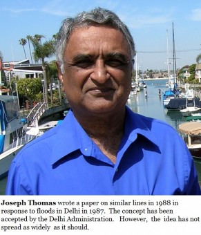
My first posting was in Srinagar. So I have lived there and seen the river bunds and the low lying terrain. However, the principle of dredging instead of bunds was developed in 1988 in response to floods in Delhi in 1987.
The pictures were gathered from the internet.
As to why the flood control engineers use a very complicated, expensive and ineffective method — you’ve got to ask them.
I agree with you that both disciplines are part of fluid dynamics. It’s not only the technical understanding of an issue, what’s striking is level of your interest and observation as well as the ability to gather info and express in a convincing manner.
The so-called experts shall continue dwelling upon the flood havoc which regularly affects some part of the country every year.
Thanks Lalit. Yes, interest and observation are required. For e.g., the wheel has existed for thousands of years. But it is only recently that somebody got the idea of putting wheels on luggage.
Very nice ! Congrats and thank you for sharing !
Hey Nutso!!
Nice job.
so you can declare to the world: “No, I’m not all wet!”
Thomas,
In addition to all that has come as ‘comments’ on this post, I have received a few phone calls. During social gatherings also, this subject came up for discussion. One group of people feels that it is all very well to write papers like this and post them on websites or publish them in periodicals. They believe that it just amounts to churning water. They believe that nothing really comes out of it.
When I disagree with them, they get annoyed. They become even more angry if I ask them, “And pray, what good comes out of going around a golf course hitting a hapless ball and cheating on the score card…or sitting on the bridge table and picking quarrels on the ‘conventions’ and executing contracts!”
I think you can give some cogent answers to this question.
Personally, I am happy to observe that the issue has received a good response. If something good comes out of it, good luck. If nothing happens, we have lost nothing. The Holy Gita specifically asks us to act without an eye on reward or acknowledgement (In Hindi, they say, ‘karma phal ki ichha mat kar’ )
Surjit
Thanks Surjit. This article is our contribution to flood relief. I do believe that it is worth more than mere cash.
___________________________
The late Pres Reagan observed that one can achieve a lot if we are prepared to give the credit to others.
_________________________
All large projects are team efforts. But a journey of a thousand miles starts with one step. Unless that first step is taken, nothing happens.
_________________________
“Churning the water” or not, lots of things do come out of an article like this. At the very least, it makes people think and debate. I have written several papers like this. Many have produced results.
This news report says that dredging work in river Jhelum will start in November.
http://www.greaterkashmir.com/news/2014/Oct/31/devastating-floods-silt-up-jhelum-72.asp
Whether our article led to this decision or not, I’m glad that we are moving in the right direction.
This is our answer to the cynics.
Surjit,
Many thanks .
Regards,
Amarjit
Surjit,
This is a work of genius- well researched, logical, lucid and so valuable. My compliments to Your Coursemate Thomas- he is brilliant and beyond.
Have copied it to my youngest Brother, a former CE of J&K with a suggestion to agitate for planned/monitored follow-up, both in the short and long-term.
Rest is in Higher-hands!
YNS
Sent from my iPad
Dear Gen Yogi Sharma sir,
I plead NOT GUILTY.
However, if you are saying that I have a knack for ignoring the clutter and getting to the essentials, then I have been accused of it before. This article is more akin to the small boy who blurted out the truth that the emperor was naked.
The requirement to dredge and de-silt the river channel is so obvious that even a schoolboy should be able to say so. Even the science I have explained is school level science.
It was Gen Surjit who compelled me to write this article. I had written a similar one in 1988 in response to floods in Delhi in 1987. The concept was accepted by the Delhi Administration and (informally) by a member of the Central Water Commission. So when these floods occurred, I attributed it to the general apathy that prevails in our country.
The difference between 1988 and 2014 is that we now have the internet, social media and easy availability of satellite imagery. It is the visuals in this article that have made the difference. This 2014 article has had more impact than the original 26 years ago.
Considering the comments that have come in, there is a massive requirement to also dredge the Brahmaputra, Ganga, Yamuna, Kosi, Ravi, Beas, Sutlej and other rivers. A journey of a thousand miles has to start with one step. Half a step has been taken in Delhi. Maybe Srinagar will now take a full step.
Good insights about the Srinagar valley. Now I understand why water is not receding after the rains.
Nice post, Joseph.
I had not looked at the orography around Srinagar and did not know that it sat on such a broad and long alluvial plain. Global warming, and the associated unpredictability of precipitation, is apparently transforming the riverine city of Srinagar to a lacustrine environment.
Flood control measures, involving widening channels + de-silting operations and building higher flood walls, will probably be more cost effective than moving the city.
However, as the words from the Dao De Jing suggest, Water eventually trumps Rock.
This has reference to Brig Vidyasagar’s mail regarding floods in Brahmaputra. I was Goc 2 Mtn Div in 1994-96. I was aware of the Brahmaputra Flood Control Board. However, not once did they do anything to control the floods.
We had a monitoring system upstream of three main Rivers, Lohit, Siang and Subansiri to get the water levels in these rivers(tributaries of Brahmaputra) every day by way of sitreps from the units located in these areas. The DCs and our Govt Installations viz ONGC, Indian Oil, Assam Oil, Digboi refinery and some others were always kept informed of likely inundation to enable them to take necessary steps to warn the population as well as the installations to ensure minimum loss of life and equipment.But as brought out by Vidyasagar, every year it was the Army who went out to control the situation and evacuate/ drop food to the stranded population. I later found out that BFCB had adequate equipment and funding for such known emergencies, but to the best of my knowledge it is the Army Engineers using Army equipment which was used every year on being requisitioned by the Civil administration.
When will we learn and hold the concerned authorities responsible/accountable…?!!
Dredging of water ways is nothing new in India as well. It has employed to
ensure minimum depths for
of water. There is no other way to ensure better situations than to employ
regular dredging exercises. I
have personally seen this being employed through the year in the sea water
approach lanes in Waltair
Harvour (Vishakhapatnam Harvour) which lead to Hindustan Shipyard and
beyond for both Naval Base
and other users.
It will be wrong to say that authorities do their part of the professional
work on short time basis only to
encash their share. The problems may be lying some where else ie lack of
Long Term Vision and or
Funds and may be both with added disadvantage of red-tape affected Systems.
As far as J&K is
concerned, the possibilities of flooding of the valley is known fact
through various studies of the past.
Why timely correction actions were not taken, is an issue which proper
enquiries only can rightly
bring out the truth.
It is an environmental/climate change/s issue and disasters/catastrophes
will continue to happen
over the Globe as we can not tame the same but with better scientific
knowledge and systems at
hand, the world today is definitely better placed for better and more
accurate predictions/forecasts
to handle such crises. The Indian State has to rise above board to meet
such challenges. Will our
System stand the test of challenges in future is big question which the
Govt alone can answer and
apprise the Indian citizenry.
Reason why an obvious solution ie dredging is not used is because persons in authority eg politicians and Babus are not interested in long term solution they like recurring expenditure to help themselves and their friends.
yes indeed, dear Tomy. It is such a common knowledge, well known and
regularly practiced by every one of the local farmers in Kerala for
controlling and guiding the flow of serious down pour during SW Monsoon (
particularly in Karkataka months, year after year, to save their paddy crop
). They simply dredge and prepare the channel along the boundary of their
field to enable the rapid flow of their downpour waters through miles long
spread of fields, and enable their crops to grow undisturbed. Dredging is
the time tested practice in areas prone to flooding. The yearly formation,
accumulation and deposit of sands, sludge and clay needs timely removal to
enable unrestricted flow of water, and so prevent spreading /
flooding………mkc…….
Dear Thomas,
An excellent article on the history of floods in river Jhelum. Last major work was done by the British Govt on the request of the King then. After that the Govts have been quite reticent in this matter. No work has been done for dredging leave aside the maintenance dredgeing. This is the condition of many rivers in India. Haphazard development on the river banks and many places even on the river beds have added to the problem. Mumbai and Hyderabad are examples. Musi river is almost non existent. Feeder nallas are also blocked.
Let us hoe that the Govt wakes up now before it is too late.
Great piece of work Joe. But will the powers that be listen? They will leave it all to the PWD and wash their hands off. Its the way it has always been. Every one is into Vastu Shastra these days despite which all our cities are such a mess.
Excellent piece. Extremely well written. The solution from a historical perspective looks so simple and the British had solved it for us. But our greed and shortsightedness of politicians and builders ruined it all. The poor as usual pay for it the most.
A simply brilliant, if slightly technical, current analysis with some shrewd and hard-hitting suggestions for the future.
You must read this in conjunction with Shankar Aiyar’s terrific Article today in the New Indian Express at
http://www.newindianexpress.com/columns/shankkar_aiyar/Why-not-Rebuild-and-Showcase-Srinagar-as-India’s-First-Smart-City/2014/09/21/article2441157.ece
(if the hyper-link doesn’t take you there, copy/paste the entire link till “ece”)
The consensus from these two acute and far-sighted observers appears to be – build a new Srinagar away from the flood plains, on higher ground and let it be India’s first “smart” City. Interesting……….and will require a lot of political will at both the Centre and the State.
Great article. Could you send me a copy to circulate among friends?
Thanks,
A comprehensive and lucid report. Is there anyone to take notice? Such a disaster is such an opportunity to bleed the public of India in the name of help. But no-one seems to want to solve the problem over the long term.
Joe.
When ever I read such informative pieces in layman language, I wonder if the right people who matter are reading them?
I hope you can send it to Omar and other ministers to learn from this knowledge based article.
I understood it all in such a short time.
well done,
Dave Sood
Dave,
Thanks. My experience is that “the right people who matter” are sensitive to public opinion. So it is important to convince the public at large. The process is slow. But we have to start somewhere.
A fine scientific article. Well done.
The last diagram: is the flow from right to left, against the arrows, from uphill to downhill?
How does the Pamba Irrigation work? Does it not control flood as well as help irrigation?
Thanks.
I had to write the article quickly before people lose interest in the subject. Searched the internet for an appropriate diagram to illustrate the Law of Continuity. This was the best I could find. I don’t have the computer skills to draw diagrams myself — other than drawing something and then scanning it. May do it after this initial rush is over.
The diagram shows a convergent nozzle which speeds up the flow as it goes from left to right. I have mentioned under the diagram “A river in flood has flow from high speed to low speed.” That means from right to left. As long as the flow is below the speed of sound, the flow is reversible. Not a problem in water flow.
Yes, dams do control floods because they fill up in the wet season and water is let out in the dry season. Some dams e.g. on the Damodar river in India and the Mississippi – Missouri in US are specifically built for flood control. Though most Indian dams are multi-purpose — flood control + irrigation + electricity generation.
The Pamba dam and the canals are for irrigation. Though Kerala gets so much rain that canals are not required. I believe that this particular project happened because the irrigation department always wants to have something to do.
Is it confidence, competence or integrity that is the issue ? The narratives below suggest all three may be at stake when it comes to flood control…
Paul,
I don’t think integrity is the problem. If a corrupt official can make money out of levee (bund) construction, he can just as easily make money from dredging.
I think the two problems are apathy and the common Indian belief that brains reside only in white skins. Of course, these two traits kill confidence and competence.
Fortunately, the situation is improving. The younger generations are better than us.
Ashok Sahil ke ye char misrey, iss masley ke insaani pehloo ki taraf tawajo dilaatey hain-
Falak Ke Kehair, Sitaaron Ki Badd- Duaaon Se Darro
Zamin Ke Sabar-O-Tahamul Ki, Intehaa Se Darro
Yeh Haadisey, Yahi Paighaam De Rahey Hain Tumhen
Agar Azaab Se Bachna Hai, To Khuda Se Darro
Falak= sky, Kehair= calamity, Badd=bad, Tahamul= tolerance, Intehaa= excess, Azaab= God’s curse
Surjit,
Very informative and easy to understand. Excellent research done by the author.
Vinod Bahl
Dear Sir,
An excellent article on River Jhelum and urgent need to de silt the river and also its tributaries by Mr J.Thomas.
Even in Assam you see only bunds to contain flood waters in River Brahmaputra consturcted at Dibrugarh and downstream to protect the adjoining villages. Though I had three tenures in that area (2 Mtn Div, 5 Mtn Div and 21 Mtn Div), I seldom saw any dredging activity undertaken.
There is Flood Control Dept in Govt of Assam and I do not what they do. When floods hit Assam every year, this dept’s main task appears to requisition services of Army and Air Force.
Tons of money is spent on procurement of sand bags to reinforce bunds and fill up breaches caused by River Brahmaputra.
Even in Punjab, I have not seen any worthwhile dredging in Rivers Beas, Sutlej and Ravi. But what we see are River Training works whch are simply putting boulders contained by wire mesh and put all along the banks over long distances. In every flood these are displaced and money is spent in replacing them. This is the major task undertaken by Punjab Irrigation Dept.
I am sure veterans from Punjab would be able to throw more light on this.
We Indians have never learnt our lessons. Nor are we interested learn such lessons. You will see in few weeks time, it is business as usual in J & K. Britishers have taught us how to control floods but we want floods every year to make few Govt employees, contractors and politicians millionaires.
On the other hand you see DCB maintained by Army is desilted every year by the BRO company in area of 11 Corps. So water even when accumulated does not pose any problem to the safety of DCB.
Dear sir,
Thanks. As you are an experienced Engineer officer, I’m glad to get an endorsement from you.
I started on this when there were floods in Delhi in 1987. I thought it was obvious that the Yamuna river should be dredged and de-silted. I wrote a more detailed paper at that time. But we did not have the internet and 24/7 TV then. So the word did not spread very much. I have to thank Gen Surjit Singh for insisting that I write about Srinagar now. Times have changed. Due to the internet and groups like Google Plus and Facebook, the paper has already spread around the globe.
It is so obvious that dredging is the answer. And the British engineers dredged the Jhelum using a steam powered dredger back in 1902. The only explanation I can give as to why the bunds are favoured today is that US Army Engineers use bunds to control floods in the Mississippi – Missouri river basin. Everybody else seems to be following them. However, the Mississippi and Missouri rivers flood every now and then. When hurricane Katrina hit New Orleans, the damage was as bad as Srinagar is suffering now.
I hope our country has reached the level where we have confidence in ourselves and can do things based on logic rather than blind copying.
Everything in the paper is confirmed by latest survey reports. Why the flood channel was not used is beyond belief. Omar Abdullah’s government reflects his own incompetence. The situation threatens to escalate to the level of a catastrophe with the winter two weeks away and all food and fuel destroyed. With the state government clueless and the central government dragging its feet the future for the affected people looks bleak indeed.
Sir,
Thanks. I believe the flood channel operates automatically when the water level in the river reaches the danger level. You can see in the first picture that the flood channel is full.
My cousin was passing through Srinagar on 3rd Sept. On the way to the airport, the driver showed him the flood channel which was full at that time. People were staring at it but did nothing. The rest is history.
To be fair to the state govt officials, almost all of them are victims of the flood themselves.
The Central govt, especially the Armed Forces, the paramilitary forces and the NDRF are doing an Herculean job.
Dear Sir,
An excellent paper by your course mate, wish authorities that be take notice of it.
Two requests:
1. I edit a magazine ‘Geointelligence’.
You can view current and back issues of the magazine on. http://www.geospatialworld.net
Would like to reproduce his article in our next issue, with appropriate credits. We also organise an annual conference by the same name as the magazine in June. Would like him to present this in one of the plenary sessions of the conference under disaster management.
2.Gen JJ Singh, ex COAS and ex Governer Arunachal is writing a book on North East. You had written about your course mate having flown over and photographed the NE extensively. I had mentioned this to the general and he wanted to get in touch with him. Seek his permission to give his contact details.
And am attaching some light reading.
Warm regards,
Ajay
Dear Veteran Ajai Chandele,
Thanks.
Not sure whether we have met. I guess you are an Engineer officer and have served with the Survey of India. I’ve had the privilege of serving six years in aerial photography where we worked closely with The Survey of India. The two tenures were 9 years apart. So I had the chance to survey the whole country twice.
I’ve glanced through the home page of geospatialeworld. From my side, you are welcome to reproduce the article in the magazine.
I will be honoured to present a paper at your annual conference in June. We can connect directly for the details.
You are welcome to forward my contact details to Gen JJ Singh.
regards,
J Thomas
An excellent expose put across in very simple very well articulated language.
The solution indeed lies in annual dredging programme before every monsoon. Whereas the initial effort would be massive because of neglect over the years after a very laudable dredging thought process, the effort which would need be put in over the subsequent years would be much less. With the technological development the dredging machine can be expected to be more efficient making even the initial effort manageable. The annual regularity could be put in place through Standing Operating Procedures (SOP) which are annually budgeted catered for implementation ensured through political level overseen implementation progress review. The chances of neglect due to forgetfulness would be avoided and the Srinagar valley would be saved for perpetuity.
Abandoning present Srinagar and rebuilding another in a higher place is not the answer because the current Srinagar would in any case have still to be cared for.
Thank you sir.
I am not taking a position on whether a new city should be built. I only wanted to issue a caution that merely repairing the breaches in the bunds will not solve the problem. It is necessary to dredge and de-silt the river. The spoil obtained from dredging could be put on the bunds, thus raising their height.
It is vitally important to dredge and lower the river bed level. It should come below street level. Only then will the city be safe.
In addition, we need to go back in time, expand or restore the Dal Lake to its original coverage. The catchment area needs to be reforested to reduce siltation issues, and the silt removed be used to raise the ground level, at least for designated critical installations. Reconstruction building designs should cater for stilts, for the basement/ground level, that can be used for parking, common areas etc.
Excellent suggestions sir. Thanks.
Sir,
I have passed on this information to all friends on my mailing list.
Bharat Bhushan Ghai
Sir,
Since the rivers flow completely in mountainous region, what Veteran Joseph Thomas has suggested is essential to be undertaken as early as possible, so that the water can be flowing within the sides of the channel and is not likely to spread outside. The cross section area of the river flow must be increased by deepening and widening wherever possible.
I have visited and studied the Ganges river valley in its flow from its origin to हरद्वार where it starts flowing into plains. I feel the condition in that region is more or less similar as in J & K (of Jhelum River) except with steeper slope. At उत्तरकाशी , Ganges floods its course nearly every year. Just because water quantity was restricted and course is deeper the situation does not reflect similar to that at श्रीनगर (now). There I had suggested constructing underground power houses at about 20-25 Kms apart with bunds (dto divert water to the powerhouses and tailrace tunnels to leave the (Power House) water back to the river channel. In J & K only about 3 or 4 bunds may be needed to generate electricity in each power house. I am attaching my report written for the Ganges basin with this e-mail. Some modifications may be required but generally the same Report can hold good for Jhelum river as well. My suggestion in the form of an article entitled “Small Hydroelectric Power Projects in Himalayan Region” was sent to NHEP Hq and they had liked the idea then. I, of course, am unaware about any progress in that aspect. A copy of my suggestion was also sent to Secretary of Uttarakhand Government a decade back. You may probably pass this article to Veteran Joseph Thomas for his consideration also. In addition to achieving flood control some electricity also can be generated.
Let me hope they find my suggestion useful for this condition now.
With regards,
——Mukund Apte (Veteran)
Thank you sir. Your idea of having run-of-the-river hydroelectric power plants that would bypass the towns along the rivers in Uttarakhand is excellent. Please accept my congratulations.
These days the internet and social media are powerful. You should update your paper (if necessary), add lots of pictures and publish on the internet and social media. In general, govt officials go by popular opinion. So, only when the general public supports your idea will the govt officials implement it.
A good article. Logical and sensible!
A fascinating analysis that delves in to the reasons for the massive flooding, as well as suggests solutions. While the Short-term solution is as suggested in Option I, viz. dredging and work on the flood channel, for the long term, designing a new city seems to be the answer, but one the political leadership will not take, not just because of the cost, but on account of peripheral issues that seem to be more important to the Political leadership. We need visionaries for the latter, besides pressure from the people.
My compliments to Joseph for a no-nonsense analysis, presented in simple terms.
Thank you, sir.
A similar situation arose in respect of New Orleans after hurricane Katrina. Initially the talk was to completely rebuild the city. But over a period of time, opinions changed. Only part of the original city has been rebuilt. The very low lying areas have been left alone. Perhaps something like that can be done in Srinagar also. New construction should be on higher ground.
As meticulously told as ever!
Thomas,
Great text and pics and evidence of lessons we don’t seem to learn. Wonder if changing climatic patterns contributed to this disaster and if so, how much. Man is, in the end, quite helpless against the powers of nature. There was a plan (an ex Naval chief was involved) to connect all the rivers in India to guard against such calamities…you know of this?
Glo
Thanks Glo. A climatic pattern can be said to be established if it manifests itself over several decades. We do seem to be getting more extreme weather phenomena but to pronounce it as climate change requires a lot of data taken over several decades and a lot of analysis.
In this case, the river has been silting up over the 60 years since dredging was last done. As far as I know, the bunds on either side have not been raised. So this flood was inevitable. I don’t agree that we are quite helpless against nature. What was the need to build houses in low lying areas ? Kashmir has plenty of high ground. And when water was overflowing into the flood channel as early as 03 Sept, people were just staring at it. Nobody heeded that danger signal. Nobody cared to evacuate the city. The last straw was the heavy rain on 6/7 night.
Yes, I think all of us have heard of the plan to connect all the rivers of India. But it is meant more for irrigation and drinking water than for flood control. The idea is to build a large barrage on the Ganga just before Patna and take the water south, all the way to the Kaveri. I think it is far too expensive, both in land and in money. Far better to have small, local rain water harvesting projects.
The situation is similar to that in New Orleans after hurricane Katrina. Initially, there was talk of completely rebuilding New Orleans. In course of time, the plans changed. I believe that the very low lying areas have not been re-built.
Great article. Plan B seems a good idea that needs to be evaluated. Just like a modern London emerged after the great fire of 1666, perhaps a modern Srinagar can evolve after this devastating flood. It will require a visionary architect to prepare a plan with layout and structural designs that ensure the unique character and style of the city is not lost. I know that is a tall order and may never happen. But one can always hope.
Paul,
Rescue work is still going on. Medium and long range plans will only be made after this phase. Hopefully, this article will contribute to a decision in favour of dredging and bringing the river bed back to its original level i.e. below street level.
Good read but what exactly is being done ?